Back إقليم سينغيدا Arabic TanzaniaSingidaGola AVK Сингида (регион) Bulgarian Regió de Singida Catalan Singida Region CEB Singida (region) Danish Singida (Region) German Περιφέρεια Σινγκίντα Greek Regiono Singida Esperanto Región de Singida Spanish
Singida Region
Mkoa wa Singida (Swahili) | |
|---|---|
|
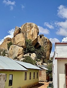
From top to bottom: Lake Singidani, Misuni Rocks in Misuni ward, Singida & High rise in Utemeni ward, Singida Municipal | |
| Nickname: Tanzania's heartland | |
 Location in Tanzania | |
| Coordinates: 6°44′43.08″S 34°9′11.52″E / 6.7453000°S 34.1532000°E | |
| Country | |
| Zone | Lake |
| Region | 15 October 1963 |
| Capital | Singida |
| Districts | |
| Government | |
| • Regional Commissioner | Peter Serukamba (CCM) |
| Area | |
• Total | 49,340 km2 (19,050 sq mi) |
| • Land | 48,345 km2 (18,666 sq mi) |
| • Water | 95 km2 (37 sq mi) |
| • Rank | 5th of 31 |
| Highest elevation (Kidagau) | 1,816 m (5,958 ft) |
| Population (2022) | |
• Total | 2,008,058 |
| • Rank | 16th of 31 |
| • Density | 41/km2 (110/sq mi) |
| Demonym | Singidan |
| Ethnic groups | |
| • Settler | Swahili |
| • Native | Nyaturu, Iramba, Isanzu, Datooga, Kimbu & Nyamwezi |
| Time zone | UTC+3 (EAT) |
| Postcode | 43xxx |
| Area code | 026 |
| ISO 3166 code | TZ-23[1] |
| HDI (2018) | 0.548[2] low· 12th of 25 |
| Website | Official website |
| Symbols of Tanzania | |
| Bird |  |
| Butterfly | |
| Fish | |
| Mammal | |
| Tree |  |
| Mineral | |
Singida Region (Mkoa wa Singida in Swahili) is one of Tanzania's 31 administrative regions. The region covers a land area of 49,340 km2 (19,050 sq mi).[3] The region is comparable in size to the combined land area of the nation state of Slovakia.[4] The Region is bordered to the north by Shinyanga Region, Simiyu Region and Arusha Region, to the northeast by Manyara Region, to the east by Dodoma Region, to the southeast by Iringa Region, to the southwest by Mbeya Region and to the west by Tabora Region. The regional capital is the municipality of Singida.[5] According to the 2022 national census, the region had a population of 2,008,058.[6][7]
- ^ "IS0 3166". ISO. Retrieved 2022-10-09.
- ^ "Sub-national HDI - Area Database - Global Data Lab". hdi.globaldatalab.org. Archived from the original on 2018-09-23. Retrieved 2020-02-26.
- ^ "Singida Region Size".
- ^ 49,035 km2 (18,933 sq mi) for Slovakia at "Area size comparison". Nations Online. 2022. Retrieved 14 January 2023.
- ^ "Singida Region Investment Guide" (PDF). The Regional Commissioner's Office, Singida. July 2020. Retrieved 2023-01-21.
- ^ "Tanzania: Regions and Cities - Population Statistics, Maps, Charts, Weather and Web Information". www.citypopulation.de. Retrieved 2024-02-09.
- ^ "Tanzania country profile" (PDF). Archived (PDF) from the original on 2021-08-31. Retrieved 2022-12-20.


