Back بحيرة سونغلا Arabic بحيره سونجلا ARZ Сангхла (возера) Byelorussian Тхалелуанг CV Songkhla-See German Lago Songkhla Spanish Lac Songkhla French Danau Songkhla ID ソンクラー湖 Japanese თალელუანგი Georgian
| Songkhla Lake | |
|---|---|
 | |
 | |
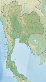
| Location | Malay Peninsula |
| Coordinates | 7°12′N 100°28′E / 7.200°N 100.467°E |
| Catchment area | 8,020 km2 (3,100 sq mi)[1] |
| Basin countries | Thailand |
| Surface area | 1,040 km2 (400 sq mi) |
| Average depth | 1.4 metres (4 ft 7 in) |
| Water volume | 1.6 km3 (0.38 cu mi) |
| Surface elevation | 0 metres (0 ft) |
| Islands | Ko Yo, Ko Nang Kham, Ko Mak, Ko See Ko Ha, |
| Settlements | Songkhla |
Songkhla Lake (Thai: ทะเลสาบสงขลา, RTGS: Thale Sap Songkhla, IPA: [tʰa.leː sàːp sǒŋ.kʰlǎː]) is the largest natural lake in Thailand. It is on the Malay Peninsula in the southern part of the country. Covering an area of 1,040 km2 it borders the provinces of Songkhla and Phatthalung. Despite being called a lake, it is actually a lagoon complex.
The lake is divided into three distinct parts. The southern part opens with a 380 m wide strait to the Gulf of Thailand at the city of Songkhla. Here it contains brackish water about half the salinity of seawater. Further north, after a narrowing to 6 km width, is the Thale Luang (782.80 km2). At the northern end between mangrove swamps is the 28 km2 Thale Noi in Phatthalung Province. The most striking feature is the long 75 km long spit which separates the lake from the sea. Unlike most spits, it was probably formed when originally existing islands were connected by silting from the lake precursor.
- ^ "Lake Songkhla | World Lake Database – ILEC". Archived from the original on 2019-11-16. Retrieved 2019-11-16.
