Back Suid-Yorkshire Afrikaans Yorkshire d'o Sud AN جنوب يوركشير Arabic ساوث يوركشير ARZ South Yorkshire AST Yorkshire Kelod BAN Паўднёвы Ёркшыр BE-X-OLD Южен Йоркшър Bulgarian দক্ষিণ ইয়র্কশায়ার Bengali/Bangla Su Yorkshire Breton
South Yorkshire | |
|---|---|
 | |
| Coordinates: 53°30′N 1°20′W / 53.500°N 1.333°W | |
| Sovereign state | United Kingdom |
| Constituent country | England |
| Region | Yorkshire and the Humber |
| Established | 1 April 1974 |
| Established by | Local Government Act 1972 |
| Time zone | UTC+0 (GMT) |
| • Summer (DST) | UTC+1 (BST) |
| UK Parliament | List of MPs |
| Police | South Yorkshire Police |
| Ceremonial county | |
| Lord Lieutenant | Andrew Coombe |
| High Sheriff | Mrs Carole O'Neill[1] (2020–21) |
| Area | 1,552 km2 (599 sq mi) |
| • Rank | 38th of 48 |
| Population (2022)[2] | 1,392,105 |
| • Rank | 10th of 48 |
| Density | 897/km2 (2,320/sq mi) |
| Ethnicity | 90.7% White 3.4% S.Asian 2.0% Black 1.5% Mixed 2.5% Other |
| Metropolitan county | |
| Government | South Yorkshire Mayoral Combined Authority |
| Mayor | Oliver Coppard (L) |
| Admin HQ | Sheffield |
| GSS code |
|
| ITL | TLE3 |
| Website | southyorkshire-ca |
| Districts | |
 Districts of South Yorkshire Metropolitan districts | |
| Districts | |
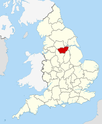
South Yorkshire is a ceremonial county in the Yorkshire and the Humber region of England. It borders North Yorkshire and West Yorkshire to the north, the East Riding of Yorkshire to the north-east, Lincolnshire to the east, Nottinghamshire to the south-east, and Derbyshire to the south and west. The largest settlement is the city of Sheffield.
The county is largely urban, with an area of 1,552 km2 (599 sq mi) and a population of 1,402,918. The largest settlements after Sheffield (556,500) are the city of Doncaster (113,566), Rotherham (109,697), and Barnsley (96,888). The east and west of the county are more rural. The county is governed by four metropolitan boroughs: Barnsley, City of Doncaster, Rotherham, and City of Sheffield. They collaborate through South Yorkshire Mayoral Combined Authority.
South Yorkshire lies on the edge of the Pennines, and the west of the county contains part of the Peak District National Park. The River Don rises in these hills, and flows through Sheffield, Rotherham, and Doncaster before reaching the flat Humberhead Levels in the east of the county.
- ^ "No. 62943". The London Gazette. 13 March 2020. p. 5161.
- ^ "Mid-2022 population estimates by Lieutenancy areas (as at 1997) for England and Wales". Office for National Statistics. 24 June 2024. Retrieved 26 June 2024.


