Back جبل سوثيرن وپلاندس ARZ Паўднёва-Шатландскае ўзвышша Byelorussian Южношотландски възвишения Bulgarian Na Monaidhean a Deas Breton Southern Uplands Welsh Southern Uplands German Southern Uplands Spanish Lõuna-Šoti mägismaa Estonian سادرن آپلندز Persian Southern Uplands French


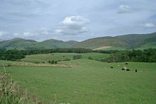
The Southern Uplands (Scottish Gaelic: Na Monaidhean a Deas) are the southernmost and least populous of mainland Scotland's three major geographic areas (the others being the Central Lowlands and the Highlands). The term is used both to describe the geographical region and to collectively denote the various ranges of hills and mountains within this region. An overwhelmingly rural and agricultural region, the Southern Uplands are partly forested and contain many areas of open moorland - the hill names in the area are congruent with these characteristics.