Back Stockholmská aglomerace Czech Stockholm (tiheasustusega paikkond) Estonian Tukholma (taajama) Finnish Unité urbaine de Stockholm French Stockholms tätort FRR Stockholm (tettsted) NB Stockholm (tätort) Swedish Stockholm urban area ZH-MIN-NAN
Stockholm urban area | |
|---|---|
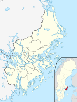
 Stockholm urban area (in blue) | |
| Coordinates: 59°20′N 18°04′E / 59.333°N 18.067°E | |
| Country | Sweden |
| Province | Södermanland and Uppland |
| County | Stockholm County |
| Municipality | |
| Area | |
| • Total | 381.63 km2 (147.35 sq mi) |
| Population (31 December 2019)[1] | |
| • Total | 1,593,426 |
| • Density | 4,175/km2 (10,810/sq mi) |
| Time zone | UTC+1 (CET) |
| • Summer (DST) | UTC+2 (CEST) |
The Stockholm urban area (Swedish: Stockholms tätort) is the largest and most populous of the statistical localities or urban areas in Sweden. It has no administrative function of its own, but constitutes a continuous built-up area, which extends into 11 municipalities in Stockholm County. It contains the municipal seats of 10 of those. As of 31 December 2019, the population in the Stockholm urban area was 1,593,426 inhabitants, the area 381.63 km2 (147.35 sq mi), and the population density 4,175 inhabitants/km2.[1] Stockholm urban area is not the same as Metropolitan Stockholm (Storstockholm), which is a much larger area.
In 2019, the population of the urban area and the municipalities into which it extends, broken down per municipality was the following:[2]
| Municipality | Population | ||||
|---|---|---|---|---|---|
| In Stockholm urban area |
In other urban areas |
Other | Total | % in Stockholm urban area | |
| Stockholm | 974,073 | 0 | 1831 | 975,904 | 100.0 |
| Huddinge | 110,252 | 1,448 | 771 | 112,848 | 97.7 |
| Järfälla | 79,830 | 0 | 160 | 79,990 | 99.8 |
| Solna | 82,429 | 0 | 0 | 82,429 | 100.0 |
| Sollentuna | 68,835 | 4,313 | 81 | 73,857 | 93.2 |
| Botkyrka | 62,156 | 26,191 | 2,137 | 94,606 | 65.7 |
| Haninge | 53,599 | 27,371 | 4,806 | 92,095 | 58.2 |
| Tyresö | 44,370 | 3,118 | 402 | 48,333 | 91.8 |
| Sundbyberg | 52,414 | 0 | 0 | 52,414 | 100.0 |
| Nacka | 38,394 | 56,085 | 1,112 | 105,189 | 36.5 |
| Danderyd | 27,074 | 5,477 | 23 | 32,857 | 82.4 |
| Total | 1,593,426 | 124,003 | 9,623 | 1,750,522 | 91.0 |
- ^ a b c "Localities 2010, area, population and density in localities 2005 and 2010 and change in area and population". Statistics Sweden. 29 May 2012. Archived from the original on 16 January 2013.
- ^ "Tätorter; arealer, befolkning - Statistiska centralbyrån". www.scb.se. Archived from the original on 2013-12-02.

