Back Subak BAN Subak Czech Subak (Bewässerungsgemeinschaft) German सुबक (सिंचाई) DTY Subak Spanish Subak Basque Subak (keinokastelu) Finnish Subak French סובאק HE Subak ID
| UNESCO World Heritage Site | |
|---|---|
 Balinese altar at rice terraces near Gunung Batukaru | |
| Official name | Cultural Landscape of Bali Province: the Subak System as a Manifestation of the Tri Hita Karana Philosophy |
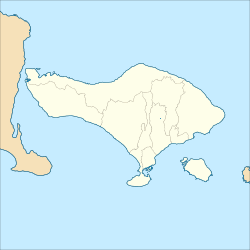
| Location | Bali, Indonesia |
| Includes |
|
| Criteria | Cultural: (iii), (v), (vi) |
| Reference | 1194rev |
| Inscription | 2012 (36th Session) |
| Area | 19,519.9 ha (48,235 acres) |
| Buffer zone | 1,454.8 ha (3,595 acres) |
| Coordinates | 8°15′33″S 115°24′10″E / 8.25917°S 115.40278°E |
Subak is the water management (irrigation) system for the paddy fields on Bali island, Indonesia. It was developed in the 9th century. For the Balinese, irrigation is not simply providing water for the plant's roots, but water is used to construct a complex, pulsed artificial ecosystem[1] that is at the same time autonomous and interdependent.[2] The system consists of five terraced rice fields and water temples covering nearly 20,000 hectares (49,000 acres). The temples are the main focus of this cooperative water management, known as subak.
- ^ Lansing, J.S. (1987). "Balinese "Water Temples" and the Management of Irrigation". American Anthropologist. 89 (2): 326–341. doi:10.1525/aa.1987.89.2.02a00030. JSTOR 677758.
- ^ Wardana 2015, p. 1.

