Back Tatra Milli Parkı Azerbaijani Татра милли паркы Bashkir Taman Nasional Tatra, Polandia BAN Татранскі нацыянальны парк Byelorussian Татранскі нацыянальны парк (Польшча) BE-X-OLD Татренски национален парк (Полша) Bulgarian Tatranský národní park (Polsko) Czech Tatra Nationalpark (Polen) Danish Tatra-Nationalpark (Polen) German Parque nacional Tatra (Polonia) Spanish
| Tatra National Park | |
|---|---|
| Tatrzański Park Narodowy | |
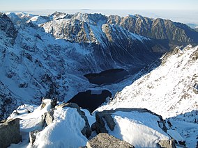
 Mountain lakes of Czarny Staw pod Rysami and Morskie Oko seen from Poland's highest point, the north-western summit of Rysy, 2,499 metres (8,199 ft) in elevation.
 | |
| Location | Tatra Mountains, southern Poland |
| Nearest city | Zakopane |
| Coordinates | 49°14′39″N 19°57′20″E / 49.2443°N 19.9556°E |
| Area | 211.64 km2 (81.71 mi2) |
| Established | 1954 |
| Governing body | Ministry of the Environment |
| Official name | Glacial lakes in the Tatra National Park |
| Designated | 11 December 2017 |
| Reference no. | 2340[1] |
| Official name | Peat bogs in the Tatra National Park |
| Designated | 11 December 2017 |
| Reference no. | 2341[2] |
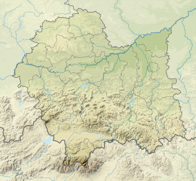
Tatra National Park (Polish: Tatrzański Park Narodowy; abbr. TPN) is a national park located in the Tatra Mountains in Tatra County, in the Lesser Poland Voivodeship in central-southern Poland.[3] The park is headquartered in the town of Zakopane.[4]
The Tatra Mountains form a natural border between Poland to the north and Slovakia to the south, and the two countries have cooperated since the early 20th century on efforts to protect the area. Slovakia created an adjoining national park, and UNESCO later designated the area a transboundary biosphere reserve.
- ^ "Glacial lakes in the Tatra National Park". Ramsar Sites Information Service. Retrieved 25 April 2018.
- ^ "Peat bogs in the Tatra National Park". Ramsar Sites Information Service. Retrieved 25 April 2018.
- ^ en.poland.gov: Tatra National Park . accessed 5.12.2013
- ^ "Biuletyny Informacji Publicznej". bip.malopolska.pl. Retrieved 2023-05-04.

