Back Teuva (munisipyo) CEB Teuva German Teuva Esperanto Teuva Spanish تئووا Persian Teuva Finnish Teuva French Teuva Galician Teuva Italian ტეუვა Georgian
Teuva
Östermark | |
|---|---|
Municipality | |
| Teuvan kunta Östermarks kommun | |
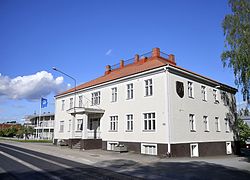
 Municipal office | |
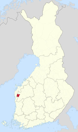
 Location of Teuva in Finland | |
| Coordinates: 62°29′10″N 21°44′50″E / 62.48611°N 21.74722°E | |
| Country | |
| Region | South Ostrobothnia |
| Sub-region | Suupohja sub-region |
| Charter | 1868 |
| Government | |
| • Municipal manager | Veli Nummela |
| Area (2018-01-01)[1] | |
| • Total | 556.05 km2 (214.69 sq mi) |
| • Land | 554.73 km2 (214.18 sq mi) |
| • Water | 1.35 km2 (0.52 sq mi) |
| • Rank | 154th largest in Finland |
| Population (2023-12-31)[2] | |
| • Total | 4,758 |
| • Rank | 172nd largest in Finland |
| • Density | 8.58/km2 (22.2/sq mi) |
| Population by native language | |
| • Finnish | 96.7% (official) |
| • Swedish | 0.9% |
| • Others | 2.4% |
| Population by age | |
| • 0 to 14 | 14.1% |
| • 15 to 64 | 51.6% |
| • 65 or older | 34.3% |
| Time zone | UTC+02:00 (EET) |
| • Summer (DST) | UTC+03:00 (EEST) |
| Website | www.teuva.fi |
Teuva (Swedish: Östermark) is a municipality of Finland.
It is located in the South Ostrobothnia region. The population of Teuva is 4,758 (31 December 2023)[2] and the municipality covers an area of 554.73 km2 (214.18 sq mi) of which 1.35 km2 (0.52 sq mi) is inland water (1 January 2018).[1] The population density is 8.58/km2 (22.2/sq mi).
The municipality is unilingually Finnish.
- ^ a b "Area of Finnish Municipalities 1.1.2018" (PDF). National Land Survey of Finland. Retrieved 30 January 2018.
- ^ a b "Population growth biggest in nearly 70 years". Population structure. Statistics Finland. 2024-04-26. ISSN 1797-5395. Retrieved 2024-04-29.
- ^ "Population growth biggest in nearly 70 years". Population structure. Statistics Finland. 2024-04-26. ISSN 1797-5395. Retrieved 2024-04-29.
- ^ "Population according to age (1-year) and sex by area and the regional division of each statistical reference year, 2003–2020". StatFin. Statistics Finland. Retrieved 2 May 2021.
- ^ a b "Luettelo kuntien ja seurakuntien tuloveroprosenteista vuonna 2023". Tax Administration of Finland. 14 November 2022. Retrieved 7 May 2023.
