Back مقاطعة تولاند (كونيتيكت) Arabic مقاطعه تولاند ARZ Condáu de Tolland AST Tolland County, Connecticut BAR Толънд (окръг, Кънектикът) Bulgarian টোলল্যান্ড কাউন্টি, কানেকটিকাট BPY Tolland Gông (Connecticut) CDO Толланд (гуо, Коннектикут) CE Tolland County CEB Tolland County, Connecticut Welsh
Tolland County | |
|---|---|
 | |
 Location within the U.S. state of Connecticut | |
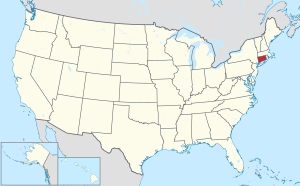
 Connecticut's location within the U.S. | |
| Coordinates: 41°51′N 72°20′W / 41.85°N 72.33°W | |
| Country | |
| State | |
| Founded | 1785 |
| Named for | Tolland, Somerset |
| Seat | none (since 1960) Tolland (1785-1889) Rockville (1889-1960) |
| Largest town | Vernon |
| Area | |
| • Total | 417 sq mi (1,080 km2) |
| • Land | 410 sq mi (1,100 km2) |
| • Water | 6.8 sq mi (18 km2) 1.6% |
| Population (2020) | |
| • Total | 149,788 |
| • Density | 359.2/sq mi (138.7/km2) |
| Time zone | UTC−5 (Eastern) |
| • Summer (DST) | UTC−4 (EDT) |
| Congressional district | 2nd |
Tolland County (/ˈtɑːlənd/ TAH-lənd) is a county in the northeastern part of the U.S. state of Connecticut. As of the 2020 census, its population was 149,788.[1] It is incorporated into 13 towns and was originally formed on October 13, 1785, from portions of eastern Hartford County and western Windham County.
The county is included in the Hartford-East Hartford-Middletown, CT Metropolitan Statistical Area.
Counties in Connecticut have no governmental function; all legal power is vested in the state, city and town governments. The office of High Sheriff in Connecticut counties was officially abolished by ballot in 2000, and corrections and court services were transferred to the state marshals. Tolland County has the same boundaries as the Tolland Judicial District. On June 6, 2022, the U.S. Census Bureau formally recognized Connecticut's nine councils of governments as county equivalents instead of the state's eight counties. Connecticut's county governments were disbanded in 1960, and the councils of governments took over some of the local governmental functions. Connecticut's eight historical counties continue to exist in name only, and are no longer considered for statistical purposes.[2]
- ^ "Census - Geography Profile: Tolland County, Connecticut". United States Census Bureau. Retrieved November 20, 2021.
- ^ https://www.federalregister.gov/documents/2022/06/06/2022-12063/change-to-county-equivalents-in-the-state-of-connecticut Federal Register: Change to County-Equivalents in the State of Connecticut
