Back ترايل (كولومبيا البريطانية) Arabic ترایل، بریتیش کولومبیا AZB Trail (lungsod sa Kanada, British Columbia, lat 49,10, long -117,70) CEB Trail (Britská Kolumbie) Czech Trail (British Columbia) German Trail, Kolombiyay Britanya DIQ Trail (Columbia Británica) Spanish تریل، بریتیش کلمبیا Persian Trail Finnish Trail (Canada) French
This article needs additional citations for verification. (December 2014) |
This article is missing information about overall town history, 1948 Columbia River flood. (January 2022) |
Trail
Trail Creek | |
|---|---|
| City of Trail | |
 | |
| Motto: Explore Your Trail | |
Location of Trail in British Columbia | |
| Coordinates: 49°05′40″N 117°42′33″W / 49.09444°N 117.70917°W[1] | |
| Country | Canada |
| Province | British Columbia |
| Region | Kootenays |
| Regional district | Kootenay Boundary |
| Government | |
| • Type | Elected city council |
| • Mayor | Colleen Jones[2] |
| • Governing body | Trail City Council |
| • MP | Richard Cannings (NDP) |
| • MLA | Katrine Conroy (BC NDP) |
| Area (2021)[3] | |
• Total | 34.90 km2 (13.47 sq mi) |
| • Census agglomeration | 279.13 km2 (107.77 sq mi) |
| Elevation | 435 m (1,427 ft) |
| Population (2021)[3] | |
• Total | 7,920 |
| • Density | 226.9/km2 (588/sq mi) |
| • Census agglomeration | 279.13 |
| • Census agglomeration density | 51.1/km2 (132/sq mi) |
| Time zone | UTC−08:00 (PST) |
| • Summer (DST) | UTC−07:00 (PDT) |
| Forward sortation area | |
| Area code(s) | 250, 778, 236, and 672 |
| Highways | 3B 22 |
| Waterways | Columbia River |
| Website | trail |
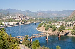
Trail is a city in the western Kootenays region of the Interior of British Columbia, Canada. It was named after the Dewdney Trail, which passed through the area.[5] The town was first called Trail Creek or Trail Creek Landing, and the name was shortened to Trail in 1897.[6]
- ^ "Trail". Geographical Names Data Base. Natural Resources Canada.
- ^ "Inside City Hall". Trail BC. Retrieved 2014-11-16.
- ^ a b Cite error: The named reference
2021censuswas invoked but never defined (see the help page). - ^ Canada Flight Supplement. Effective 0901Z 16 July 2020 to 0901Z 10 September 2020.
- ^ Barman, Jean The West Beyond the West, University of Toronto Press, 2007, p. 130.
- ^ Hamilton, William (1978). The Macmillan Book of Canadian Place Names. Toronto: Macmillan. p. 51. ISBN 0-7715-9754-1.

