Back Propinsi Trang ACE محافظة ترانغ Arabic Транг (правінцыя) Byelorussian Транг Bulgarian চাংৱাত তরাং BPY Trang Hū CDO Changwat Trang (lalawigan sa Thayland) CEB پارێزگای ترانگ CKB Trang (Provinz) German Provincia de Trang Spanish
Trang
ตรัง | |
|---|---|
| Other transcription(s) | |
| • Malay | Terang (Rumi) |
| • Southern Thai | ตรัง (pronounced [traŋ˨˩˦˥˧]) ทับเที่ยง (pronounced [tʰáp̚.tʰîǎːŋ]) |
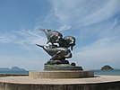
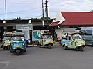
(Clockwise from top left) Ko Lao Liang Phi in Mu Ko Phetra National Park, Hat Chao Mai National Park at sunset, Dugongs statue at Pak Meng Beach, Tuk-tuk hua kob (frog-headed auto rickshaw) unique vehicle of the province, Pak Meng Beach, Kantang railway station | |
| Motto(s): ชาวตรังใจกว้าง สร้างแต่ความดี ("The generous people of Trang, to create only good.") | |
 Map of Thailand highlighting Trang province | |
| Country | Thailand |
| Capital | Trang |
| Government | |
| • Governor | Khajornsak Charoensopha (since October 2020) |
| Area | |
| • Total | 4,918 km2 (1,899 sq mi) |
| • Rank | Ranked 43rd |
| Population (2018)[2] | |
| • Total | 643,116 |
| • Rank | Ranked 41st |
| • Density | 131/km2 (340/sq mi) |
| • Rank | Ranked 34th |
| Human Achievement Index | |
| • HAI (2022) | 0.6481 "somewhat high" Ranked 29th |
| GDP | |
| • Total | baht 73 billion (US$2.1 billion) (2019) |
| Time zone | UTC+7 (ICT) |
| Postal code | 92xxx |
| Calling code | 075 |
| ISO 3166 code | TH-92 |
| Website | www |
Trang (Thai: ตรัง, Thai pronunciation: [trāŋ]; Malay: Terang), also called Mueang Thap Thiang, is one of the southern provinces (changwat) of Thailand, on the west side of the Malay Peninsula facing the Strait of Malacca. Neighboring provinces are (from north clockwise) Krabi, Nakhon Si Thammarat, Phatthalung, and Satun.
Trang was formerly a port involved in foreign trade. It was the first place where rubber was planted in Thailand. Phraya Ratsadanupradit Mahison Phakdi brought rubber saplings from Malaya and planted them here in 1899, and rubber is now an important export of the country. The Trang River flows through the province from its origin in the Khao Luang mountain range, and the Palian River flows from the Banthat mountains. The province of Trang has an area of approximately 5,000 square km and 199 km of Strait of Malacca shoreline.[5]
- ^ Advancing Human Development through the ASEAN Community, Thailand Human Development Report 2014, table 0:Basic Data (PDF) (Report). United Nations Development Programme (UNDP) Thailand. pp. 134–135. ISBN 978-974-680-368-7. Retrieved 17 January 2016, Data has been supplied by Land Development Department, Ministry of Agriculture and Cooperatives, at Wayback Machine.
{{cite report}}: CS1 maint: postscript (link)[dead link] - ^ "รายงานสถิติจำนวนประชากรและบ้านประจำปี พ.ศ.2561" [Statistics, population and house statistics for the year 2018]. Registration Office Department of the Interior, Ministry of the Interior (in Thai). 31 December 2018. Retrieved 20 June 2019.
- ^ "ข้อมูลสถิติดัชนีความก้าวหน้าของคน ปี 2565 (PDF)" [Human Achievement Index Databook year 2022 (PDF)]. Office of the National Economic and Social Development Council (NESDC) (in Thai). Retrieved 12 March 2024, page 28
{{cite web}}: CS1 maint: postscript (link) - ^ "Gross Regional and Provincial Product, 2019 Edition". <>. Office of the National Economic and Social Development Council (NESDC). July 2019. ISSN 1686-0799. Retrieved 22 January 2020.
- ^ "Trang". Tourism Authority of Thailand (TAT). Archived from the original on 19 June 2012. Retrieved 18 May 2015.


