Back نهر تريبيا ARZ Требия Bulgarian Trèbia Catalan Fiume Trebbia CEB Trebia Czech Треббия CV Trebbia German Trebia EML Trebia Spanish Trebbia Basque
| Trebbia | |
|---|---|
 The Trebbia valley in July, a few kilometres upstream from Bobbio | |
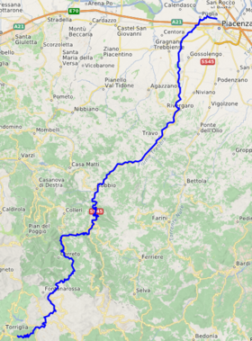
 Location of the Trebbia. | |
| Location | |
| Country | Italy |
| Physical characteristics | |
| Source | |
| • location | Monte Prelà, Ligurian Apennines |
| • elevation | 800 m (2,600 ft) |
| Mouth | Po |
• location | just upstream from Piacenza |
• coordinates | 45°04′13″N 9°41′06″E / 45.0702°N 9.6849°E |
• elevation | 61 m (200 ft) |
| Length | 118 km (73 mi)[1] |
| Basin size | 1,150 km2 (440 sq mi)[2] |
| Discharge | |
| • average | 40 m3/s (1,400 cu ft/s)[2] |
| Basin features | |
| Progression | Po→ Adriatic Sea |
The Trebbia (stressed Trèbbia; Latin: Trebia) is a river predominantly of Liguria and Emilia Romagna in northern Italy. It is one of the four main right-bank tributaries of the river Po, the other three being the Tanaro, the Secchia and the Panaro.
Along its eastern banks in 218 BC was fought one of the battles of the Second Punic War: the Battle of Trebbia, where Hannibal defeated a Roman consular army.
The 1,150-square-kilometre (440 sq mi) drainage basin is divided among Emilia Romagna, 770 square kilometres (300 sq mi), Liguria, 349 square kilometres (135 sq mi), and Lombardy, 31 square kilometres (12 sq mi). Its principal tributaries are the torrents Aveto and Perino (from the right) and the torrent Boreca (from the left).[2]
- ^ "Geography of the Trebbia Valley" (in Italian and English). Associazione Pro Loco Gorreto. 2006. Retrieved 2 April 2009.
- ^ a b c Cani, Antonella (2003). "Progetto integrato per il risanamento del fiume Trebbia" (in Italian). Giovanni Giavelli, Departmento di Scienze Ambientali, Università degli Studi di Parma. Archived from the original on 26 March 2008. Retrieved 29 March 2009.