Back ترويزين ARZ Trizin Azerbaijani Troizína CEB Τροιζήνα Greek Trecén Spanish Trezena Basque Trézène (ville) French Trecén Galician טרויזן HE Թրիզինա HYW
This article needs additional citations for verification. (January 2011) |
Troezen
Τροιζήνα | |
|---|---|
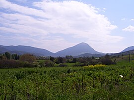
 Ortholithi mountain | |
| Coordinates: 37°29′N 23°21′E / 37.483°N 23.350°E | |
| Country | Greece |
| Administrative region | Attica |
| Regional unit | Islands |
| Municipality | Troizinia-Methana |
| Area | |
| • Municipal unit | 190.697 km2 (73.629 sq mi) |
| Elevation | 23 m (75 ft) |
| Population (2021)[1] | |
| • Municipal unit | 4,668 |
| • Municipal unit density | 24/km2 (63/sq mi) |
| • Community | 734 |
| Time zone | UTC+2 (EET) |
| • Summer (DST) | UTC+3 (EEST) |
| Postal code | 180 20 |
| Area code(s) | 22980 |
| Website | www.dimos-trizinas.gr |
Troezen (/ˈtriːzən/; ancient Greek: Τροιζήν, modern Greek: Τροιζήνα [tri'zina]) is a small town and a former municipality in the northeastern Peloponnese, Greece, on the Argolid Peninsula. Since the 2011 local government reform it is part of the municipality Troizinia-Methana, of which it is a municipal unit. It is part of the Islands regional unit.[2] Population 4,668 (2021).
Troezen is located southwest of Athens, across the Saronic Gulf, and a few miles south of Methana. The seat of the former municipality was in Galatas. Before 2011, Troizina was part of the Argolis and Korinthos prefecture from 1833 to 1925, Attica prefecture from 1925 to 1964, Piraeus Prefecture from 1964 to 1972 and then back in Attica prefecture (in antiquity it was part of Argolis). The municipality had a land area of 190.697 km2.[3] Its largest towns and villages are Galatás, Kalloní, Troizína, Taktikoúpoli, Karatzás, Dryópi, Ágios Geórgios, and Agía Eléni. There are numerous smaller settlements.
- ^ "Αποτελέσματα Απογραφής Πληθυσμού - Κατοικιών 2021, Μόνιμος Πληθυσμός κατά οικισμό" [Results of the 2021 Population - Housing Census, Permanent population by settlement] (in Greek). Hellenic Statistical Authority. 29 March 2024.
- ^ "ΦΕΚ B 1292/2010, Kallikratis reform municipalities" (in Greek). Government Gazette.
- ^ "Population & housing census 2001 (incl. area and average elevation)" (PDF) (in Greek). National Statistical Service of Greece.

