| Tuncurry New South Wales | |||||||||||||||
|---|---|---|---|---|---|---|---|---|---|---|---|---|---|---|---|
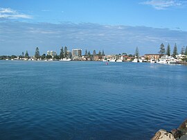
 View from Tuncurry's netted 'Rockpool' beach | |||||||||||||||
| Coordinates | 32°10′30″S 152°29′56″E / 32.17500°S 152.49889°E | ||||||||||||||
| Population | 6,376 (2021 census)[1] | ||||||||||||||
| Postcode(s) | 2428 | ||||||||||||||
| Elevation | 6 m (20 ft) | ||||||||||||||
| Time zone | AEST (UTC+10) | ||||||||||||||
| • Summer (DST) | AEDT (UTC+11) | ||||||||||||||
| Location |
| ||||||||||||||
| LGA(s) | Mid-Coast Council | ||||||||||||||
| Region | Mid North Coast | ||||||||||||||
| State electorate(s) | Myall Lakes | ||||||||||||||
| Federal division(s) | Lyne | ||||||||||||||
| |||||||||||||||
Tuncurry is a coastal town in the Mid North Coast region of New South Wales, Australia, in the Mid-Coast Council LGA, about 307 km (191 mi) north north east of Sydney. It is immediately adjacent to its twin town of Forster, which is the larger of the two towns.
- ^ Australian Bureau of Statistics (28 June 2022). "Tuncurry". 2021 Census QuickStats. Retrieved 13 March 2024.

