Back توين فولز Arabic توين فولز ARZ توین فالز، آیداهو AZB Туин Фолс Bulgarian Twin Falls Catalan Твин-Фоллс (Айдахо) CE Twin Falls (kapital sa kondado) CEB Twin Falls, Idaho Welsh Twin Falls DAG Twin Falls German
Twin Falls, Idaho | |
|---|---|
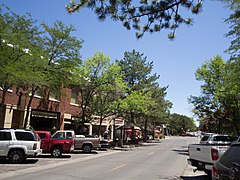
 Downtown Twin Falls in 2016 | |
| Motto: People Serving People | |
 Location of Twin Falls in Twin Falls County, Idaho. | |
| Coordinates: 42°33′20″N 114°28′15″W / 42.55556°N 114.47083°W | |
| Country | United States |
| State | Idaho |
| County | Twin Falls |
| Incorporated | April 12, 1905 |
| Government | |
| • Type | council-manager |
| • Mayor | Ruth Pierce [1] |
| • City Manager | Travis Rothweiler[2] |
| Area | |
| • City | 19.47 sq mi (50.43 km2) |
| • Land | 19.36 sq mi (50.13 km2) |
| • Water | 0.11 sq mi (0.30 km2) |
| Elevation | 3,734 ft (1,138 m) |
| Population | |
| • City | 51,807 |
| • Estimate (2022)[6] | 54,300 |
| • Density | 2,593.49/sq mi (1,001.34/km2) |
| • Metro | 110,708 |
| Time zone | UTC-7 (MST) |
| • Summer (DST) | UTC-6 (MDT) |
| ZIP Code | 83301 (street addresses) 83303 (PO Boxes) |
| Area code(s) | 208, 986 |
| FIPS code | 16-82810 |
| GNIS feature ID | 0398273[4] |
| Interstate | |
| U.S. Route(s) | |
| Website | http://www.tfid.org |
Twin Falls is the county seat and largest city of Twin Falls County, Idaho, United States.[7] The city had a population of 51,807 as of the 2020 census.[8] In the Magic Valley region, Twin Falls is the largest city in a 100-mile (160 km) radius, and is the regional commercial center for south-central Idaho and northeastern Nevada.[9] It is the principal city of the Twin Falls metropolitan statistical area, which officially includes the entirety of Twin Falls and Jerome Counties.[10] The border town resort community of Jackpot, Nevada, 50 mi (80 km) south at the state line, is unofficially considered part of the greater Twin Falls area.[11] Located on a broad plain at the south rim of the Snake River Canyon, Twin Falls, is where daredevil Evel Knievel attempted to jump across the canyon in 1974 on a steam-powered rocket. The jump site is northeast of central Twin Falls, midway between Shoshone Falls and the Perrine Bridge.
- ^ Brown, Nathan. "Barigar Picked as New Twin Falls Mayor", Times-News, January 5, 2016. (Retrieved January 5, 2016)
- ^ Twin Falls, ID - Official Website - City Manager Archived March 27, 2015, at the Wayback Machine (Retrieved January 17, 2012)
- ^ "2019 U.S. Gazetteer Files". United States Census Bureau. Retrieved July 9, 2020.
- ^ a b U.S. Geological Survey Geographic Names Information System: Twin Falls, Idaho
- ^ Cite error: The named reference
wwwcensusgovwas invoked but never defined (see the help page). - ^ "Population and Housing Unit Estimates". United States Census Bureau. May 24, 2020. Retrieved May 27, 2020.
- ^ "Find a County". National Association of Counties. Archived from the original on July 4, 2012. Retrieved June 7, 2011.
- ^ Twin Falls (city) QuickFacts from the US Census Bureau Archived January 1, 2012, at the Wayback Machine (Retrieved January 17, 2012)
- ^ City of Twin Falls Comprehensive Plan Update Retrieved May 7, 2007 Archived September 12, 2008, at the Wayback Machine
- ^ Twin Falls designated as metropolitan area years earlier than expected Retrieved January 7, 2018
- ^ Twin Falls visitidaho.org Archived August 23, 2010, at the Wayback Machine Retrieved May 7, 2007

