Back Onbemande vliegtuig Afrikaans Unmannod lyftwægn ANG مسيرة (طائرة) Arabic Vehículu aereu non tripuláu AST Pilotsuz uçuş aparatı Azerbaijani اینسانسیز اوچوش وسیلهسی AZB Пилотһыҙ осоу аппараты Bashkir Drone BCL Беспілотны лятальны апарат Byelorussian Бесьпілётнік BE-X-OLD


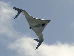
An unmanned aerial vehicle (UAV), or unmanned aircraft system (UAS), commonly known as a drone, is an aircraft with no human pilot, crew, or passengers on board. UAVs were originally developed through the twentieth century for military missions too "dull, dirty or dangerous"[1] for humans, and by the twenty-first, they had become essential assets to most militaries. As control technologies improved and costs fell, their use expanded to many non-military applications.[2] These include aerial photography, area coverage,[3] precision agriculture, forest fire monitoring,[4] river monitoring,[5][6] environmental monitoring,[7][8][9][10] policing and surveillance, infrastructure inspections, smuggling,[11] product deliveries, entertainment, and drone racing.
- ^ Tice, Brian P. (Spring 1991). "Unmanned Aerial Vehicles – The Force Multiplier of the 1990s". Airpower Journal. Archived from the original on 24 July 2009. Retrieved 6 June 2013.
When used, UAVs should generally perform missions characterized by the three Ds: dull, dirty, and dangerous.
- ^ Alvarado, Ed (3 May 2021). "237 Ways Drone Applications Revolutionize Business". Drone Industry Insights. Archived from the original on 11 May 2021. Retrieved 11 May 2021.
- ^ F. Rekabi-Bana; Hu, J.; T. Krajník; Arvin, F., "Unified Robust Path Planning and Optimal Trajectory Generation for Efficient 3D Area Coverage of Quadrotor UAVs" IEEE Transactions on Intelligent Transportation Systems, 2023.
- ^ Hu, J.; Niu, H.; Carrasco, J.; Lennox, B.; Arvin, F., "Fault-tolerant cooperative navigation of networked UAV swarms for forest fire monitoring" Aerospace Science and Technology, 2022.
- ^ Remote sensing of the environment using unmanned aerial systems (UAS). [S.l.]: ELSEVIER - HEALTH SCIENCE. 2023. ISBN 978-0-323-85283-8. OCLC 1329422815. Archived from the original on 27 February 2023. Retrieved 11 January 2023.
- ^ Perks, Matthew T.; Dal Sasso, Silvano Fortunato; Hauet, Alexandre; Jamieson, Elizabeth; Le Coz, Jérôme; Pearce, Sophie; Peña-Haro, Salvador; Pizarro, Alonso; Strelnikova, Dariia; Tauro, Flavia; Bomhof, James; Grimaldi, Salvatore; Goulet, Alain; Hortobágyi, Borbála; Jodeau, Magali (8 July 2020). "Towards harmonisation of image velocimetry techniques for river surface velocity observations". Earth System Science Data. 12 (3): 1545–1559. Bibcode:2020ESSD...12.1545P. doi:10.5194/essd-12-1545-2020. ISSN 1866-3516. Archived from the original on 12 January 2023. Retrieved 12 January 2023.
- ^ Koparan, Cengiz; Koc, A. Bulent; Privette, Charles V.; Sawyer, Calvin B. (March 2020). "Adaptive Water Sampling Device for Aerial Robots". Drones. 4 (1): 5. doi:10.3390/drones4010005. ISSN 2504-446X.
- ^ Koparan, Cengiz; Koc, Ali Bulent; Privette, Charles V.; Sawyer, Calvin B.; Sharp, Julia L. (May 2018). "Evaluation of a UAV-Assisted Autonomous Water Sampling". Water. 10 (5): 655. doi:10.3390/w10050655.
- ^ Koparan, Cengiz; Koc, Ali Bulent; Privette, Charles V.; Sawyer, Calvin B. (March 2018). "In Situ Water Quality Measurements Using an Unmanned Aerial Vehicle (UAV) System". Water. 10 (3): 264. doi:10.3390/w10030264.
- ^ Koparan, Cengiz; Koc, Ali Bulent; Privette, Charles V.; Sawyer, Calvin B. (March 2019). "Autonomous In Situ Measurements of Noncontaminant Water Quality Indicators and Sample Collection with a UAV". Water. 11 (3): 604. doi:10.3390/w11030604.
- ^ "Drones smuggling porn, drugs to inmates around the world". Fox News. 17 April 2017. Archived from the original on 31 August 2018. Retrieved 17 April 2017.