Back উচ্চ দির জেলা Bengali/Bangla Districte d'Upper Dir Catalan Upper Dīr District CEB Upper Dir German ناحیه دیر بالا Persian District du Haut-Dir French ऊपरी दीर ज़िला Hindi Dystrykt Upper Dir Polish ضلع اتلا دیر PNB پورتنۍ دیر ولسوالۍ Pashto/Pushto
Upper Dir District
ضلع دیر بالا پورتنۍ دیر ولسوالۍ | |
|---|---|
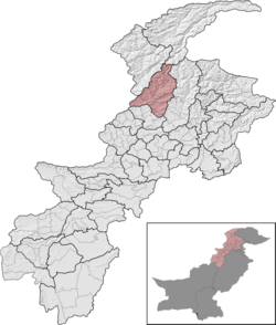
 Upper Dir District (red) in Khyber Pakhtunkhwa | |
| Country | |
| Province | |
| Division | Malakand |
| Established | 1996 |
| Headquarters | Dir |
| Government | |
| • Type | District Administration |
| • Deputy Commissioner | Gohar Zaman Wazir (BPS-18 PAS) |
| • District Police Officer | Mushtaq Ahmad (BPS-18 PSP) |
| • District Health Officer | N/A |
| Area | |
| • District of Khyber Pakhtunkhwa | 3,699 km2 (1,428 sq mi) |
| Population | |
| • District of Khyber Pakhtunkhwa | 1,083,566 |
| • Density | 290/km2 (760/sq mi) |
| • Urban | 47,842 |
| • Rural | 1,035,724 |
| Time zone | UTC+5 (PST) |
| Number of Tehsils | 6 |
| Main language(s) | Pashto ,[2]: 21 Gawri |
| Website | dirupper |
Upper Dir District (Pashto: پورتنۍ دیر ولسوالۍ, Urdu: ضلع دیر بالا) is a district located in the Malakand Division of Khyber Pakhtunkhwa province of Pakistan. The city of Dir is its district headquarter. Geographically, it is located in the northern part of Pakistan. It borders with the Chitral district on the north, Afghanistan on the northwest, the Swat district on the east, and the Lower Dir district on the south. It shares 40 to 50 kilometers border with Afghanistan.

