Back أوتارا كانادا Arabic اوتارا كانادا ARZ उत्तर कन्नड़ जिला Bihari উত্তর কন্নড় জেলা Bengali/Bangla Districte de North Kanara Catalan Uttar Kannada CEB Uttara Kannada German Distrito de Uttara Kannada Spanish Uttara Kannada barrutia Basque بخش اتر Persian
Uttara Kannada | |
|---|---|
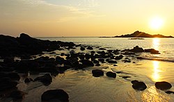
Clockwise from top-left:Sathodi Falls in Kanur, Murudeshwar Temple, Kali River Bridge at Karwar, Om Beach at Gokarna, Madhukesvara Temple at Banavasi | |
| Nickname: Kashmir of Karnataka | |
 | |
 | |
| Coordinates: 14°36′N 74°42′E / 14.6°N 74.7°E | |
| Country | |
| State | Karnataka |
| Established | 1 November 1956 |
| Talukas | |
| Government | |
| • District Minister | Mankal S Vaidya |
| • MP | Vishweshwar Hegde Kageri |
| • DC | Lakshmi Priya. K , I.A.S[1] |
| Area | |
| • Total | 10,291 km2 (3,973 sq mi) |
| • Rank | 5th |
| Elevation Average | 600 m (2,000 ft) |
| Population (2011)[2] | |
| • Total | 1,437,169 |
| • Rank | 20th |
| • Density | 140/km2 (400/sq mi) |
| Languages | |
| • Official | Kannada[3] |
| Time zone | UTC+5:30 (IST) |
| PIN | 581xxx |
| Telephone code | +91 0(838x) |
| ISO 3166 code | IN-KA |
| Vehicle registration | |
| Coastline | 142 kilometres (88 mi) |
| Literacy | 84.06% |
| Lok Sabha constituency | Uttara Kannada |
| Climate | Monsoon (Köppen) |
| Precipitation | 2,835 millimetres (111.6 in) |
| Avg. summer temperature | 33 °C (91 °F) |
| Avg. winter temperature | 20 °C (68 °F) |
| Website | uttarakannada |
Uttara Kannada is a fifth largest district in the Indian state of Karnataka, It is bordered by the state of Goa and Belagavi districts to the north, Dharwad District and Haveri District to the east, Shivamogga District, and Udupi District to the south, and the Laccadive Sea to the west. Karwar is the district headquarters, Kumta and Sirsi are the major commercial centers in the district. The district's agroclimatic divisions include the coastal plain consisting of Karwar, Ankola, Kumta, Honnavar Bhatkal taluks and Malenadu consisting of Sirsi, Siddapur, Yellapur, Haliyal, Dandeli, Joida, Mundgod taluks.
- ^ https://uttarakannada.nic.in/en/
- ^ a b "District Census 2011: Uttara Kannada" (PDF). Registrar General and Census Commissioner of India. Retrieved 17 February 2012.
- ^ "Report of the commissioner for linguistic minorities in india | page 99" (PDF). minorityaffairs.gov.in.


