Back مقاطعة والكر (تكساس) Arabic والکر بؤلگهسی، تکزاس AZB Walker County, Texas BAR Уолкер (акруга, Тэхас) Byelorussian Уокър (окръг, Тексас) Bulgarian ৱাকের কাউন্টি, টেক্সাস BPY Walker Gông (Texas) CDO Walker County (kondado sa Tinipong Bansa, Texas) CEB Walker County (Texas) Czech Walker County, Texas Welsh
Walker County | |
|---|---|
 The Walker County Courthouse in 2022 | |
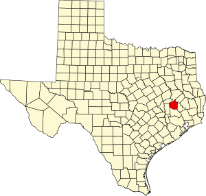
 Location within the U.S. state of Texas | |
 Texas's location within the U.S. | |
| Coordinates: 30°44′N 95°34′W / 30.74°N 95.57°W | |
| Country | |
| State | |
| Founded | 1846 |
| Named for | Robert J. Walker, Renamed for Samuel H. Walker |
| Seat | Huntsville |
| Largest city | Huntsville |
| Area | |
| • Total | 802 sq mi (2,080 km2) |
| • Land | 784 sq mi (2,030 km2) |
| • Water | 17 sq mi (40 km2) 2.2% |
| Population (2020) | |
| • Total | 76,400 |
| • Density | 95/sq mi (37/km2) |
| Time zone | UTC−6 (Central) |
| • Summer (DST) | UTC−5 (CDT) |
| Congressional districts | 8th, 17th |
| Website | www |
Walker County is a county located in the east central section of the U.S. state of Texas. As of the 2020 census, its population was 76,400.[1] Its county seat is Huntsville.[2] Initially, Walker County was named for Robert J. Walker, a legislator from Mississippi who introduced into the United States Congress the resolution to annex Texas. Walker later supported the U.S. during its Civil War and earned some enmity for it. In order to keep the county's name, the state renamed it for Samuel H. Walker (no relation), a Texas Ranger and soldier in the United States Army.
Walker County comprises the Huntsville Micropolitan Statistical Area which is part of the Houston-The Woodlands Combined Statistical Area.
- ^ "Walker County, Texas". United States Census Bureau. Retrieved January 30, 2022.
- ^ "Find a County". National Association of Counties. Retrieved June 7, 2011.