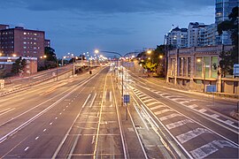
Warringah Freeway | |
|---|---|
 | |
| Southern terminus of Warringah Freeway at its junction with Pacific Highway | |
| Coordinates | |
| General information | |
| Type | Freeway |
| Length | 3.5 km (2.2 mi)[1] |
| Opened | 1968–1978 |
| Gazetted | January 1993[2] |
| Route number(s) | (Naremburn–North Sydney) |
| Former route number |
|
| Major junctions | |
| North end | Naremburn, Sydney |
| South end | Bradfield Highway North Sydney |
| Location(s) | |
| Major suburbs / towns | Crows Nest, Cammeray |
| Highway system | |
| ---- | |


Warringah Freeway is a 3.5-kilometre (2.2 mi)[1] divided freeway in Sydney, New South Wales, Australia that is part of the Sydney Orbital Network. The primary function of the freeway is to provide an alternative high-grade route from the Sydney Harbour Tunnel and Bradfield Highway at Milsons Point to the A8 and Gore Hill Freeway. The freeway reduces traffic demands on Pacific Highway throughout Sydney's Lower North Shore, bypassing North Sydney and Crows Nest,[3] and provides a vital link to access most of the suburbs in Sydney and is also a major route to the north, south, east and west of the central business district.
- ^ a b "Warringah Freeway" (Map). Google Maps. Retrieved 26 July 2023.
- ^ "State Roads Act". Government Gazette of the State of New South Wales. No. 7. National Library of Australia. 22 January 1993. pp. 223–30. Archived from the original on 4 May 2023. Retrieved 4 May 2023.
- ^ "Warringah Freeway". Key build program. Roads & Maritime Services. 2016. Retrieved 20 October 2016.

