Waterloo | |
|---|---|
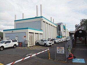
 Waterloo Water Treatment Plant | |
 | |
| Coordinates: 41°13′01″S 174°55′34″E / 41.217°S 174.926°E | |
| Country | New Zealand |
| City | Lower Hutt |
| Local authority | Hutt City Council |
| Electoral ward | Eastern Ward |
| Area | |
| • Land | 181 ha (447 acres) |
| Population (June 2024)[2] | |
• Total | 5,950 |
| Train stations | Waterloo |
| Lower Hutt CBD | Epuni | Fairfield |
| Woburn |
|
|
| Waiwhetū |
Waterloo is an eastern suburb of Lower Hutt, Wellington. It is named after the Battle of Waterloo won by the Duke of Wellington in 1815.[3]
The Hutt City Council formally defines Waterloo as the area bounded by Waterloo Road and Burnside Street in the north, the Hutt Valley railway line in the west, Guthrie Street in the south, and the Wainuiomata hills in the east.[4]
It is the home suburb to Waterloo Primary School and the Open Polytechnic of New Zealand. It is also home to Waterloo Interchange, a major train and bus station.
- ^ Cite error: The named reference
Areawas invoked but never defined (see the help page). - ^ "Aotearoa Data Explorer". Statistics New Zealand. Retrieved 26 October 2024.
- ^ Te Ara: The Encyclopedia of New Zealand – Hutt Valley – central and west Retrieved: 10 January 2009
- ^ "Hutt City Wards and Suburbs" (PDF). Hutt City Council. Retrieved 3 November 2015.
