Back واترتوون، کانتیکت AZB Watertown (Connecticut) Catalan Вотертаун (Коннектикут) CE Watertown (lungsod sa Tinipong Bansa, Connecticut) CEB Watertown, Connecticut Welsh Watertown (Connecticut) German Watertown (Connecticut) Spanish Watertown (Connecticut) Basque Watertown (Connecticut) French Watertown, Connecticut HT
Watertown, Connecticut | |
|---|---|
| Town of Watertown | |
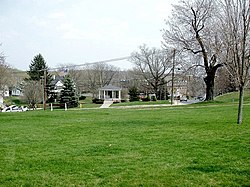
 Munson Memorial Park | |
| Coordinates: 41°36′53″N 73°07′59″W / 41.61472°N 73.13306°W | |
| Country | |
| U.S. state | |
| County | Litchfield |
| Region | Naugatuck Valley |
| Incorporated | 1780 |
| Government | |
| • Type | Council-manager |
| • Town manager | Mark A Raimo |
| • Town council |
|
| • Board of Education Commissioners |
|
| Area | |
| • Total | 29.5 sq mi (76.4 km2) |
| • Land | 29.0 sq mi (75.1 km2) |
| • Water | 0.5 sq mi (1.3 km2) |
| Elevation | 583 ft (178 m) |
| Population (2020) | |
| • Total | 22,105 |
| • Density | 762/sq mi (294.3/km2) |
| Time zone | UTC-5 (Eastern) |
| • Summer (DST) | UTC-4 (Eastern) |
| ZIP Codes | 06779, 06795 |
| Area code(s) | 860/959 |
| FIPS code | 09-80490 |
| GNIS feature ID | 0213527 |
| Website | www |
Watertown is a town in Litchfield County, Connecticut, United States. The town is part of the Naugatuck Valley Planning Region. The population was 22,105 at the 2020 census.[1] The ZIP Codes for Watertown are 06795 (for most of the town) and 06779 (for the Oakville section). It is a suburb of Waterbury. The urban center of the town is the Watertown census-designated place, with a population of 3,938 at the 2020 census.[2]
- ^ "Census - Geography Profile: Watertown town, Litchfield County, Connecticut". United States Census Bureau. Retrieved December 22, 2021.
- ^ "Census - Geography Profile: Watertown CDP, Connecticut". United States Census Bureau. Retrieved December 22, 2021.


