Back Welland River CEB Rivière Welland (Ontario) French Welland (rzeka w Kanadzie) Polish Welland River Swedish
| Welland River Chippawa Creek | |
|---|---|
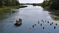
 A boat on the river | |
| Location | |
| Country | Canada |
| Province | Ontario |
| Cities | |
| Physical characteristics | |
| Source | |
| • coordinates | 43°08′44″N 79°56′18″W / 43.14542°N 79.93847°W |
| • elevation | approx. 248 m (814 ft) |
| Mouth | |
• location | Niagara River |
• coordinates | 43°03′48″N 79°02′42″W / 43.06334°N 79.04504°W |
• elevation | 166 m (545 ft)[1] |
| Length | approx. 135–140 km (84–87 mi)[2][3] |
| Width | |
| • minimum | 50 ft (15 m)[4] |
| • maximum | 100 ft (30 m)[4] |
| Discharge | |
| • location | Wellandport 43°00′18″N 79°28′57″W / 43.00500°N 79.48250°W |
| • average | 8.72 m3/s (308 cu ft/s)[5] |
| • minimum | 8.57 m3/s (303 cu ft/s)[5] |
| • maximum | 8.88 m3/s (314 cu ft/s)[5] |
| Basin features | |
| Progression | Niagara River→ Lake Ontario→ Saint Lawrence River→ Gulf of Saint Lawrence |
The Welland River (originally called the Chippawa Creek) is a river in the Golden Horseshoe that passes through the Southern Ontario cities of Welland and Niagara Falls. It flows from its source, a Drainage Basin just south of Hamilton, Ontario to meet the Niagara River.
- ^
 This article incorporates public domain material from "Elevation". The National Map. United States Geological Survey. 2019-12-14.
- ^ Lower Welland River Characterization Report (PDF) (Report). May 2011. p. 7. Archived (PDF) from the original on 2019-06-26. Retrieved 2019-12-14.
Over the course of its length of roughly 135 kilometers, the Welland River only drops approximately 82 meters in elevation.
- ^ Hogue, Tom (2014-09-17). "Bend in the river". Stories from the Hamilton Spectator. Archived from the original on 2019-12-15. Retrieved 2019-12-14.
- ^ a b Lake Survey, U. S. (April 1934). "Survey of Northern and Northwestern Lakes". U.S. Lake Survey. 43. p. 408. Retrieved 2019-12-14.
Welland River is 50 to 100 feet in width.
- ^ a b c "Monthly Discharge Data for Welland River at Wellandport". Environment and Climate Change Canada Historical Hydrometric Data. Retrieved 2019-12-14.
