Back ويندرمير Arabic بحيره ويندرمير ARZ Windermere Breton Windermere Catalan Windermere (lanaw) CEB Windermere Czech Уиндермир CV Windermere Welsh Windermere Danish Windermere German
| Windermere | |
|---|---|
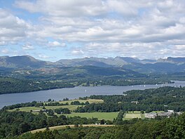
 View of Windermere | |
Location in the Lake District National Park Location in South Lakeland, Cumbria | |
| Location | Lake District National Park |
| Coordinates | 54°21′30″N 2°56′10″W / 54.35833°N 2.93611°W |
| Type | Ribbon mere |
| Primary inflows | Brathay, Rothay, Trout Beck, Cunsey Beck |
| Primary outflows | River Leven |
| Basin countries | United Kingdom |
| Max. length | 11.23 miles (18.07 km) |
| Max. width | 0.93 miles (1.50 km) |
| Surface area | 14.73 km2 (5.69 sq mi) |
| Max. depth | 219 ft (67 m) |
| Surface elevation | 128 ft (39 m) |
| Islands | 19 (Belle Isle, see list) |
Windermere or Lake Windermere[a] is a ribbon lake in Cumbria, England, and part of the Lake District.[5] It is the largest lake in England by length, area, and volume, but considerably smaller than the largest Scottish lochs and Northern Irish loughs.
The lake is about 11 miles (18 km) in length and 1 mile (1.6 km) at its widest, has a maximum depth of 64 metres (210 ft), and has an elevation of 39 metres (128 ft) above sea level. Its outflow is the River Leven, which drains into Morecambe Bay. The lake is in the administrative council area of Westmorland and Furness and the historic county of Westmorland, with the lake forming part of the boundary between the historic counties of Westmorland and Lancashire. It has been one of the country's most popular places for holidays and summer homes since the arrival of the Kendal and Windermere Railway's branch line in 1847. The Freshwater Biological Association was established on the shore of Windermere in 1929 and much of the early work on lake ecology, freshwater biology and limnology was conducted here.
- ^ "Explore Windermere, England's largest lake by boat". Windermere Lake Cruises. Retrieved 1 September 2023.
- ^ "Boat comes in for Lake Windermere". 12 March 2004. Retrieved 1 September 2023.
- ^ Vaughan, Adam (17 January 2023). "Alert at Lake Windermere over toxin levels that turned water green". The Times. Retrieved 1 September 2023.
- ^ "Windermere lake". Visit Cumbria. Retrieved 27 November 2022.
- ^ "Lake District National Park - Explore Windermere". Lakedistrict.gov.uk. Archived from the original on 3 April 2016. Retrieved 3 April 2016.
Cite error: There are <ref group=lower-alpha> tags or {{efn}} templates on this page, but the references will not show without a {{reflist|group=lower-alpha}} template or {{notelist}} template (see the help page).


