Back Wolverton German Wolverton Basque ولورتون Persian Wolverton (Buckinghamshire) French Wolverton Irish Wolverton Italian Wolverton (Milton Keynes) Dutch Wolverton NN Wolverton (Milton Keynes) NB Wolverton (Buckinghamshire) Polish
| Wolverton | |
|---|---|
 Anson Road, Wolverton | |
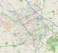
Mapping © OpenStreetMap Location within Buckinghamshire | |
| Population | 12,492 (2011, civil parish)[1] |
| OS grid reference | SP816410 |
| Civil parish | |
| Unitary authority | |
| Ceremonial county | |
| Region | |
| Country | England |
| Sovereign state | United Kingdom |
| Post town | MILTON KEYNES |
| Postcode district | MK12 |
| Dialling code | 01908 |
| Police | Thames Valley |
| Fire | Buckinghamshire |
| Ambulance | South Central |
| UK Parliament | |
Wolverton (/ˈwʊlvərtən/ WUUL-vər-tən) is a constituent town of Milton Keynes, England. It is located in the north-west of the city, beside the West Coast Main Line, the Grand Union Canal and the river Great Ouse. It is the administrative seat of Wolverton and Greenleys civil parish.
It is one of the places in historic Buckinghamshire that went into the foundation of Milton Keynes in 1967.
The village recorded in Domesday is known today as Old Wolverton but, because of peasant clearances in the early 17th century, only field markings remain of the medieval settlement. Modern Wolverton is a new settlement founded in the early 19th century as a railway town, with its centre relocated about 1 km (0.6 mi) to the southeast.
- ^ UK Census (2011). "Local Area Report – Wolverton and Greenleys CP (E04012197)". Nomis. Office for National Statistics. Retrieved 1 October 2019.

