Back উডল্যান্ডস, সিঙ্গাপুর Bengali/Bangla Woodlands (Singapur) German وودلندز (سنگاپور) Persian Woodlands (Singapore) Finnish Woodlands, Singapura ID वूडलंड्स, सिंगापूर Marathi Woodlands Malay Woodlands, Singapore SIMPLE உட்லேண்ட்ஸ், சிங்கப்பூர் Tamil วูดแลนด์ (สิงคโปร์) Thai
Woodlands | |
|---|---|
| Other transcription(s) | |
| • Chinese | 兀兰 |
| • Malay | Woodlands |
| • Tamil | ஊட்லண்ட்ஸ் |
From top left to right: Republic Polytechnic, Woodlands Town Park East, Marsiling MRT station, Woodlands MRT station, Woodlands Park Connector, HDB flats along Woodlands Drive 16 | |
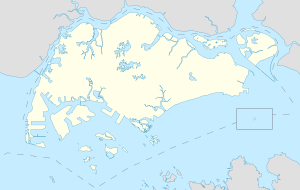
 Location of Woodlands in Singapore | |
 Location of Woodlands in Singapore | |
| Coordinates: 1°26′10.57″N 103°47′12.14″E / 1.4362694°N 103.7867056°E | |
| Country | |
| Region | North Region
|
| CDC | |
| Town councils |
|
| Constituencies | |
| Government | |
| • Mayor | North West CDC
|
| • Members of Parliament | Marsiling-Yew Tee GRC
Sembawang GRC |
| Area | |
| • Total | 16.78 km2 (6.48 sq mi) |
| • Residential | 6.90 km2 (2.66 sq mi) |
| Population | |
| • Total | 254,730 |
| • Density | 15,000/km2 (39,000/sq mi) |
| Demonym | Official
|
| Postal district | 25 |
| Dwelling units | 62,675 |
| Projected ultimate | 98,000 |
Woodlands (/ˈwʊdləndz/ ) is a planning area and residential town located in the North of Singapore. As of 2019, the town has a population of 254,733. Located approximately 25 km (16 mi) north of the central business district (CBD), it is the densest planning area and is the regional centre for the northern parts of the country.
The Woodlands planning area borders Sembawang to the east, Mandai to the south and Sungei Kadut to the west. Woodlands New Town is situated within the Woodlands planning area, which was developed during the 1980s as part of Singapore's plan to decentralise the city-centre and create self-contained residential areas throughout the country.
Woodlands also serves as one of the two international land border connections on the Singaporean side between the countries of Singapore and Malaysia at Woodlands Checkpoint, which leads to the Johor–Singapore Causeway. The other connection is the Tuas Second Link at Tuas.
- ^ a b City Population - statistics, maps and charts | Woodlands
- ^ a b "Land Area and Dwelling Units by Town". Data Singapore. 2016. Retrieved 26 January 2018.
- ^ "Statistics Singapore - Geographic Distribution - 2018 Latest Data". Retrieved 11 February 2019.


