Back نهر ياكوى ARZ Yaqui (suba) CEB Río Yaqui German Río Yaqui Spanish Río Yaqui French יאקי (נהר) HE Yaqui (rijeka) Croatian Յաքուի (գետ) Armenian Yaqui (fiume) Italian Яки (өзен) Kazakh
| Yaqui River | |
|---|---|
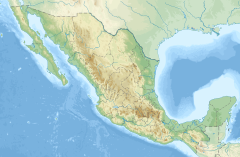
 Yaqui River - Sonora, Mexico | |
| Native name | Río Yaqui (Spanish) |
| Location | |
| Country | Mexico |
| State | Sonora |
| Physical characteristics | |
| Source | |
| • location | Sierra Madre Occidental |
| • coordinates | 29°31′48″N 109°13′42″W / 29.529887°N 109.228377°W |
| Mouth | |
• location | Gulf of California |
• coordinates | 27°40′02″N 110°36′43″W / 27.6673°N 110.6120°W |
| Length | 320 km (200 mi) |
The Yaqui River (Río Yaqui in Spanish) (Hiak Vatwe in the Yaqui or Yoreme language) is a river in the state of Sonora in northwestern Mexico. It was formerly known as the Rio del Norte.[1] Being the largest river system in the state of Sonora, the Yaqui river is used for irrigation, especially in the Valle del Yaqui.
The Rio Yaqui originates in the Sierra Madre Occidental at the junction of the Rio Bavispe and the Rio Aros at Lat. 29.529887 Long. −109.228377. It is approximately 320 km (200 mi) in length, and flows south and southwest into the Gulf of California near the city of Obregon.
Its course is interrupted by several reservoirs like Plutarco Elías Calles (El Novillo), Lázaro Cárdenas (Angostura), or Álvaro Obregón (El Oviáchic, Lake Ouiachic), which provides the water resource for the intensively irrigated region of Ciudad Obregón.
