Back Municipio de York (condado de Steuben) Spanish York udalerria, Steuben konderria (Indiana) Basque یارک ٹاؤن شپ، اسٹوبن کاؤنٹی، انڈیانا Urdu Xã York, Quận Steuben, Indiana Vietnamese 約克鎮區 (印地安納州斯托本縣) Chinese
York Township | |
|---|---|
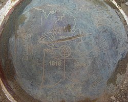
 The brass disc officially marking Indiana's border with Michigan and Ohio | |
 Location in Steuben County | |
| Coordinates: 41°39′28″N 84°50′37″W / 41.65778°N 84.84361°W | |
| Country | United States |
| State | Indiana |
| County | Steuben |
| Government | |
| • Type | Indiana township |
| Area | |
| • Total | 22.19 sq mi (57.5 km2) |
| • Land | 22.19 sq mi (57.5 km2) |
| • Water | 0 sq mi (0 km2) 0% |
| Elevation | 984 ft (300 m) |
| Population | |
| • Total | 710 |
| • Density | 33/sq mi (13/km2) |
| Time zone | UTC-5 (Eastern (EST)) |
| • Summer (DST) | UTC-4 (EDT) |
| Area code | 260 |
| GNIS feature ID | 454070 |
York Township is one of twelve townships in Steuben County, Indiana, United States. As of the 2020 census, its population was 710, down from 733 at 2010,[3] and it contained 293 housing units. York Township has the distinction of being Indiana's lone township to border both Michigan and Ohio as well as bordering two states on land as all other tri-points along Indiana's border are underwater.
- ^ "US Board on Geographic Names". United States Geological Survey. October 25, 2007. Retrieved May 9, 2017.
- ^ "Census Bureau profile: York Township, Steuben County, Indiana". United States Census Bureau. May 2023. Retrieved April 2, 2024.
- ^ "Population, Housing Units, Area, and Density: 2010 - County -- County Subdivision and Place -- 2010 Census Summary File 1". United States Census. Archived from the original on February 12, 2020. Retrieved May 10, 2013.