Zayta
زيتا Zeita | |
|---|---|
| Etymology: oil[1] | |
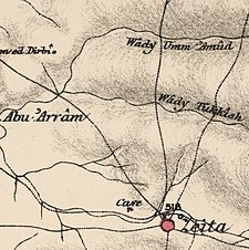
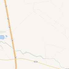
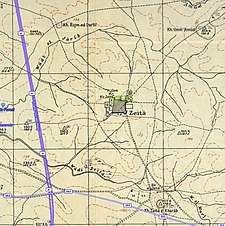
A series of historical maps of the area around Zayta, Hebron (click the buttons) | |
Location within Mandatory Palestine | |
| Coordinates: 31°38′25″N 34°49′25″E / 31.64028°N 34.82361°E | |
| Palestine grid | 133/116 |
| Geopolitical entity | Mandatory Palestine |
| Subdistrict | Hebron |
| Date of depopulation | July 17–18, 1948[3] |
| Area | |
| • Total | 10,490 dunams (10.49 km2 or 4.05 sq mi) |
| Population (1945) | |
| • Total | 330[2] |
| Cause(s) of depopulation | Military assault by Yishuv forces |
Zayta (Arabic: زيْتا Zaytā) was a Palestinian Arab village in the Hebron Subdistrict in Mandate Palestine. During Crusader rule in Palestine, the village is mentioned as forming part of the landholdings of the Order of St. John. At the time of the rule of the Ottoman Empire, according to the 1596 census, Zayta had a population of 165. Mentioned by Western travellers to the region in the 19th century, it is described by one as, "a picturesque Arab village"; by 1945, its population was 330 inhabitants.[2][4]
Until the period of Mandatory Palestine, the village was located at what is known in modern Israel as Tel Zayit; its population was moved 1.5 km north due to the nearby stagnant waters.[5] In 2005, archeologists discovered the Zayit Stone in an excavated limestone wall.
The new Zayta village was depopulated during the 1948 Arab-Israeli War between July 17–18, 1948. Its inhabitants became refugees, ending up the West Bank and Gaza Strip. All that remains of the village structures is the well that served as its main water source.
- ^ Palmer, 1881, p. 384
- ^ a b Government of Palestine, Department of Statistics, 1945, p. 23
- ^ Morris, 2004, p. xix, village #299, Also gives cause of depopulation.
- ^ Government of Palestine, Department of Statistics. Village Statistics, April, 1945. Quoted in Hadawi, 1970, p. 51
- ^ Walid Khalidi (1992). All That Remains: The Palestinian Villages Occupied and Depopulated by Israel in 1948. Washington D.C.: Institute for Palestine Studies. p. 227.
The village stood on a hill 1 km north of Wadi Zayta. It was linked by a dirt track to 'Iraq al-Manshiyya, which was located on a highway that ran from east to west between the city of al-Majdal on the coast and Bayt Jibrin. The old Zayta (Khirbat Zayta al-Kharab, 133115) was located 1.5 km south of this village on the southern bank of the wadi. (Because the wadi's stagnant waters bred insects and diseases, the population was moved during the Mandate to the new site.)


