Back روثرفورد (نيوجيرسي) Arabic Rutherford AST روترفورد، نیوجرسی AZB Rutherford (Nova Jersey) Catalan Разерфорд (Нью-Джерси) CE Rutherford (lungsod sa Tinipong Bansa, New Jersey) CEB Rutherford, New Jersey Welsh Rutherford DAG Rutherford (New Jersey) German Rutherford, New Jersey English
| Rutheford Borough | |
|---|---|
 | |
| Localizzazione | |
| Stato | |
| Stato federato | |
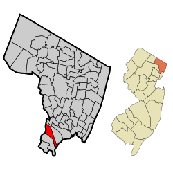
| Contea | Bergen |
| Territorio | |
| Coordinate | 40°49′13.08″N 74°06′21.6″W |
| Altitudine | 20 m s.l.m. |
| Superficie | 7,618 km² |
| Abitanti | 18 061 (2010) |
| Densità | 2 370,83 ab./km² |
| Altre informazioni | |
| Cod. postale | 07070 |
| Prefisso | 201 |
| Fuso orario | UTC-5 |
| Cartografia | |
 | |
| Sito istituzionale | |
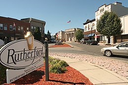
Rutheford è un borough statunitense, sito nello stato del New Jersey, Contea di Bergen.
Rutherford fu costituita come borough il 21 settembre 1881 con un atto legislativo del New Jersey, a seguito di un referendum tenutosi il giorno precedente.[1]
Rutherford fu definite "Borough of Trees" (borough degli alberi)[2] e "Il primo borough della Contea di Bergen".[3]
- ^ (EN) Snyder, John P. The Story of New Jersey's Civil Boundaries: 1606-1968 (PDF)., Bureau of Geology and Topography; Trenton, New Jersey; 1969. p. 86. Accessed February 2, 2012.
- ^ (EN) Kvasager, Whitney. "Leaves ablaze with colors of the season" (archiviato dall'url originale il 22 ottobre 2012)., The Record, October 31, 2004. Accessed October 22, 2008. "In the Saturday drizzle, Rutherford - the Borough of Trees - was living up to its title."
- ^ (EN) Rutherford Borough (archiviato dall'url originale il 10 febbraio 2009).. Accessed November 13, 2008.
