Back Almati Afrikaans አልማቲ Amharic Almaty AN ألماتي Arabic الماتى ARZ Almaty AST अलमाती AWA Almatı Azerbaijani آلماتی AZB Алматы Bashkir
Almaty Alma-Ata Алматы Алма-Ата | |
|---|---|
| Coordinates: 43°16′39″N 76°53′45″E / 43.27750°N 76.89583°E | |
| Country | Kazakhstan |
| First settled | 10–9t century BC |
| Foondit | 1854 |
| Incorporatit (ceety) | 1867 |
| Govrenment | |
| • Akim (mayor) | Akhmetzhan Yesimov |
| Area | |
| • Total | 324.8 km2 (125.4 sq mi) |
| Elevation | 500–1700 m (1640–5577 ft) |
| Population (1 August 2010)[1] | |
| • Total | 1,477,564 |
| • Density | 4152/km2 (10,750/sq mi) |
| Time zone | UTC+6 (UTC+6) |
| Postal code | 050000–050063 |
| Area code(s) | +7 727[2] |
| ISO 3166-2 | ALA |
| License plate | A |
| Website | http://www.almaty.kz |
Almaty (Kazakh: Алматы / Almatı / الماتى), an aa kent bi its umwhile names Verny (Roushie: Верный, "Faithful," prior tae 1921) an Alma-Ata (Roushie: Алма́-Ата́, atween 1921 an 1992), is the umwhile caipital an still lairgest ceety in Kazakhstan, wi a population o 1,348,500 (1 September 2008). This represents 9% o the population o the kintra.
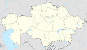
It wis the caipital o the Kazakh SSR an its successor Kazakhstan frae 1929 tae 1997. Despite losin its status as the caipital tae Nursultan in 1997, Almaty remains the major commercial centre o Kazakhstan. It is locatit in soothren Kazakhstan, near the mairch wi Kyrgyzstan.
- ↑ Agency of statistics of the Republic of Kazakhstan: Численность населения Республики Казахстан по областям с начала 2013 года до 1 февраля 2013 года Archived 2019-05-11 at the Wayback Machine (russisch; Excel-Datei; 55 kB).
- ↑ "Code Of Access". Almaly.almaty.kz. Archived frae the original on 14 August 2014. Retrieved 2 Januar 2012.


