Back Boston Afrikaans ቦስቶን Amharic Boston AN Botwulfstūn ANG بوسطن Arabic ܒܘܣܛܘܢ ARC بوسطون ARZ Boston AST Boston Aymara Boston Azerbaijani
Boston | |
|---|---|
City | |
| City of Boston | |
 | |
| Eik-name(s): | |
| Motto(s): Sicut patribus sit Deus nobis (Latin "As God wis wi oor faithers, so mey He be wi us") | |
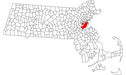
 Location in Massachusetts heichlichtit in reid. The remainder o Suffolk Coonty is heichlichtit in pink. | |
| Coordinates: 42°21′29″N 71°03′49″W / 42.35806°N 71.06361°WCoordinates: 42°21′29″N 71°03′49″W / 42.35806°N 71.06361°W | |
| Kintra | |
| Historic Kintras | Kinrick o Ingland, Kinrick o Great Breetain |
| State | |
| Historic Colony | Province o Massachusetts Bay |
| Coonty | Suffolk |
| Settled (toun) | 7 September 1630 (date o namin, O.S.) |
| Incorporatit (ceety) | 4 Mairch 1822 |
| Govrenment | |
| • Teep | Strang mayor – cooncil |
| • Mayor | Thomas M. Menino (D), tae be succeedit bi Marty Walsh (D) |
| • Cooncil | Boston City Council |
| Area | |
| • City | 232 km2 (90 sq mi) |
| • Laund | 125 km2 (48 sq mi) |
| • Water | 107 km2 (41 sq mi) |
| • Urban | 4600 km2 (1770 sq mi) |
| • Metro | 11700 km2 (4500 sq mi) |
| • CSA | 27600 km2 (10600 sq mi) |
| Elevation | 43 m (141 ft) |
| Population | |
| • City | 636,479 (US: 21st) |
| • Density | 4980/km2 (12,900/sq mi) |
| • Urban | 4,180,000 (US: 10th) |
| • Metro | 4,590,000 (US: 10t) |
| • CSA | 7600000 (US: 6t) |
| • Demonym | Bostonian |
| Time zone | UTC-5 (EST) |
| • Summer (DST) | UTC-4 (EDT) |
| ZIP code(s) | 53 total ZIP codes:[8]
|
| Area code(s) | 617 and 857 |
| FIPS code | 25-07000 |
| GNIS feature ID | 0617565 |
| Website | cityofboston.gov |
Boston (pronooncit /ˈbɒstən/ (![]() listen)) is the caipital o an maistmuckle city in Massachusetts, an is ane o the auldest cities in the Unitit States. The maistmuckle city in New Ingland, Boston is regardit as the unoffeecial "Caipital o New Ingland" for its economic an cultural impact on the hale o the New Ingland airt.[9] The city proper haed a 2009 estimatit population o 645,169 fowk, makin it the twintiet maistmuckle city in the kintra.[3] Boston is the anchor o a substantially bigger metropolitan area cried Greater Boston as weel, hame tae 4.5 million fowk an the tent-maistmuckle metropolitan area in the kintra.[6] Greater Boston as a commutin region includes sax Massachusetts coonties: Essex, Middlesex, Norfolk, Suffolk, Plymouth, Worcester,[10] northren Bristol Coonty, aw o Rhode Island an pairts o New Hampshire; it is hame tae 7.6 million fowk, makkin it the fift-maistmuckle Combined Statistical Area in the Unitit States.[7][11]
listen)) is the caipital o an maistmuckle city in Massachusetts, an is ane o the auldest cities in the Unitit States. The maistmuckle city in New Ingland, Boston is regardit as the unoffeecial "Caipital o New Ingland" for its economic an cultural impact on the hale o the New Ingland airt.[9] The city proper haed a 2009 estimatit population o 645,169 fowk, makin it the twintiet maistmuckle city in the kintra.[3] Boston is the anchor o a substantially bigger metropolitan area cried Greater Boston as weel, hame tae 4.5 million fowk an the tent-maistmuckle metropolitan area in the kintra.[6] Greater Boston as a commutin region includes sax Massachusetts coonties: Essex, Middlesex, Norfolk, Suffolk, Plymouth, Worcester,[10] northren Bristol Coonty, aw o Rhode Island an pairts o New Hampshire; it is hame tae 7.6 million fowk, makkin it the fift-maistmuckle Combined Statistical Area in the Unitit States.[7][11]
- ↑ a b c d Dalager, Norman (10 August 2006). "What's in a nickname?". The Boston Globe. Retrieved 8 Apryle 2009.
- ↑ a b Wechter 2009, p. 14.
- ↑ a b "Population and Housing Occupancy Status: 2010 – State – County Subdivision, 2010 Census Redistricting Data (Public Law 94-171) Summary File". United States Census Bureau. Retrieved 23 Mairch 2011.
- ↑ "State & County QuickFacts – Boston (city), Massachusetts". United States Census Bureau. 10 Januar 2013. Archived frae the original on 3 December 2012. Retrieved 5 Februar 2013.
- ↑ "Alphabetically sorted list of Census 2000 Urbanized Areas" (TXT). United States Census Bureau, Geography Division. Retrieved 11 Apryle 2009.
- ↑ a b "Metropolitan and micropolitan statistical area population and estimated components of change: April 1, 2000 to July 1, 2008 (CBSA-EST2008-alldata)" (CSV). United States Census Bureau, Population Division. Retrieved 11 Apryle 2009.
- ↑ a b "Combined statistical area population and estimated components of change: April 1, 2000 to July 1, 2008 (CSA-EST2008-alldata)" (CSV). United States Census Bureau, Population Division. Retrieved 11 Apryle 2009.
- ↑ "ZIP Code Lookup – Search By City". United States Postal Service. Retrieved 20 Apryle 2009.
- ↑ Steinbicker, Earl (2000). 50 one day adventures—Massachusetts, Rhode Island, Connecticut, Vermont, Maine, and New Hampshire. Hastings House/Daytrips Publishers. p. 7. ISBN 0-8038-2008-9.
- ↑ "Boston Worcester Manchester Demographic Profile: Region 19". Federal Transit Administration. 31 Januar 2007. Archived frae the original on 23 Juin 2013. Retrieved 30 August 2010. 21 pp.
- ↑ "Boston-Worcester-Manchester, MA-RI-NH Combined Statistical Area" (PDF). U.S. DEPARTMENT OF COMMERCE Economics and Statistics Administration U.S. Census Bureau. 2007. Retrieved 20 Juin 2009. Included in the CSA: MA counties: Bristol, Essex, Middlesex, Norfolk, Plymouth, Suffolk and Worcester; NH counties: Belknap, Hillsborough, Merrimack, Rockingham and Strafford; RI counties (entire state): Bristol, Kent, Newport, Providence and Washington (South County)


