Back Лесото Abkhazian Lesotho ACE Lesotho Afrikaans Lesotho ALS ሌሶቶ Amharic Lesotho AMI Lesoto AN Lesotho ANG Lesoto ANN लेसोथो ANP
Kinrick o Lesotho Muso oa Lesotho | |
|---|---|
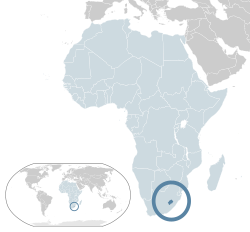
 Location o Lesotho (dark blue) – in Africa (light blue & dark grey) | |
| Caipital and largest city | Maseru 29°28′S 27°56′E / 29.467°S 27.933°E |
| Offeecial leids | |
| Ethnic groups |
|
| Demonym(s) |
|
| Govrenment | Unitary pairlamentary constitutional monarchy |
• Keeng | Letsie III |
| Moeketsi Majoro | |
| Legislatur | Pairlament |
| Senate | |
| Naitional Assembly | |
| Unthirldom | |
• frae the Unitit Kinrick | 4 October 1966 |
| Aurie | |
• Total | 30,355 km2 (11,720 sq mi) (140t) |
• Water (%) | negligible |
| Population | |
• 2009 estimate | 2,067,000[1] (144t) |
• 2004 census | 2,031,348 |
• Density | 68.1/km2 (176.4/sq mi) (138t) |
| GDP (PPP) | 2013 estimate |
• Total | $4.277 billion[2] |
• Per capita | $2,244[2] |
| GDP (nominal) | 2013 estimate |
• Tot | $2.616 billion[2] |
• Per capita | $1,372[2] |
| Gini (2003) | 52.5[3] heich |
| HDI | law · 158t |
| Currency | Lesotho loti (LSL) |
| Time zone | UTC+2 (SAST) |
| Drivin side | left |
| Cawin code | +266 |
| ISO 3166 code | LS |
| Internet TLD | .ls |
Estimates for this country explicitly tak intae accoont the effects o excess mortality due tae AIDS; this can result in lawer life expectancy, heicher infant mortality an daith rates, lawer population an growth rates, an chynges in the distribution o population by age an sex nor would itherwise be expectit. | |
Warning: Page uisin Template:Infobox kintra wi unkent parameter "area_magnitude" (this message is shown only in preview).
Lesotho (![]() i/lᵻˈsuːtuː/ li-SOO-too), offeecially the Kinrick o Lesotho, is a landlocked kintra an enclave, completely surroondit bi its anly neighbourin kintra, Sooth Africae. It is juist ower 30,000 km2 (11,583 sq mi) in size an haes a population slichtly ower twa million.[1] Its caipital an lairgest ceety is Maseru. Lesotho is a member o the Commonweel o Naitions. The name Lesotho translates roughly intae the land o the fowk who speak Sesotho.[5] Aboot 40% o the population live alaw the internaitional poverty line o US $1.25 a day.[6]
i/lᵻˈsuːtuː/ li-SOO-too), offeecially the Kinrick o Lesotho, is a landlocked kintra an enclave, completely surroondit bi its anly neighbourin kintra, Sooth Africae. It is juist ower 30,000 km2 (11,583 sq mi) in size an haes a population slichtly ower twa million.[1] Its caipital an lairgest ceety is Maseru. Lesotho is a member o the Commonweel o Naitions. The name Lesotho translates roughly intae the land o the fowk who speak Sesotho.[5] Aboot 40% o the population live alaw the internaitional poverty line o US $1.25 a day.[6]
- ↑ a b Department of Economic and Social Affairs Population Division (2009). "World Population Prospects, Table A.1" (PDF). 2008 revision. United Nations. Retrieved 12 Mairch 2009. Cite journal requires
|journal=(help) - ↑ a b c d "Lesotho". International Monetary Fund. Retrieved 17 Apryle 2013.
- ↑ "GINI index". World Bank. Retrieved 26 Julie 2013.
- ↑ "The 2013 Human Development Report – "The Rise of the South: Human Progress in a Diverse World"". HDRO (Human Development Report Office) United Nations Development Programme. pp. 144–147. Archived frae the original on 26 December 2018. Retrieved 28 November 2013.
- ↑ Itano, Nicole (2007). No Place Left to Bury the Dead. Simon and Schuster. p. 314. ISBN 0-7432-7095-9.
- ↑ Human Development Indices, Table 3: Human and income poverty, p. 35. Retrieved on 1 June 2009

