Back Islamabad ACE Islamabad Afrikaans ኢስላማባድ Amharic Islamabad AN إسلام آباد Arabic اسلام اباد ARZ ইছলামাবাদ Assamese Islamabad AST इस्लामाबाद AWA İslamabad Azerbaijani
Islamabad
اسلام آباد | |
|---|---|
| Islamabad | |
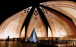
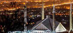
Clockwise from left: Pakistan Monument, Blue Area is the commercial centre of the city, National Assembly of Pakistan, Faisal Mosque, Margalla Hills National Park | |
| Coordinates: 33°43′N 73°04′E / 33.717°N 73.067°E | |
| Country | |
| Territory | Islamabad Capital Territory |
| Founded | 1960 |
| Government | |
| • Type | Parliamentary democratic republic |
| • Governing body | Islamabad Metropolitan Corporation and Capital Development Authority (CDA) |
| • Chief Commissioner | Aftab Akbar Durrani |
| • Deputy Commissioner | Capt(r) Mushtaq Ahmed |
| Area | |
| • Capital city | 906.5 km2 (350.0 sq mi) |
| • Land | 897.7 km2 (346.6 sq mi) |
| • Water | 8.8 km2 (3.4 sq mi) 0.97% |
| • Urban | 220.15 km2 (85.00 sq mi) |
| • Rural | 466.20 km2 (180.00 sq mi) |
| • Parks | 220.15 km2 (85.00 sq mi) |
| Highest elevation | 620 m (2,000 ft) |
| Lowest elevation | 490 m (1,610 ft) |
| Population (2017 Census)[2] | |
| • Capital city | 1,014,825 |
| • Density | 2,089/km2 (5,410/sq mi) |
| • Urban | 1,014,825 |
| • Urban density | 4,609/km2 (11,940/sq mi) |
| • Rural | 991,747 |
| • Metro | 4 million |
| Demonym | Islamabadi or Islamabadis |
| Postcode | 44000 |
| Area code | 051 |
| Notable sports teams | Islamabad United, Islamabad Jinns |
| Website | www |

Islamabad (Urdu: اسلام آباد, abode of Islam) is the Federal capital city of Pakistan. The city is located on the Pothohar Plateau in the northwest of the country. It is in the Islamabad Capital Territory, though the area has historically been a part of the Pothohar region on the crossroads of the Punjab region and the Khyber Pakhtunkhwa province (the Margalla Pass being a historic gateway to the Khyber Pakhtunkhwa, and the Pothohar Plateau historically is a part of the Punjab region). This city is rich in nature. It is surrounded by the Margalla Hills. It has a humid subtropical climate (Cwa in the Köppen climate classification). Islamabad is an expensive city to live in as the prices of most of fruits, vegetable and poultry items increased in Islamabad during the years 2015-2020.[3]
- ↑ "CDA Facts & Figures". Archived from the original on 2021-01-09. Retrieved 2019-08-05.
- ↑ "PROVISIONAL SUMMARY RESULTS OF 6TH POPULATION AND HOUSING CENSUS-2017". pbs.gov.pk. Archived from the original on 10 January 2019. Retrieved 24 November 2017.
- ↑ "Retail Prices of Vegetables, Fruits and Poultry in Islamabad from 2015-2020". Deliver It - Online Grocery Store in Islamabad. Archived from the original on 2020-04-14. Retrieved 2020-03-08.


