Back مقاطعة واشيتا (أوكلاهوما) Arabic Washita County, Oklahoma BAR Уошита (окръг, Оклахома) Bulgarian ৱাসিটা কাউন্টি, ওকলাহোমা BPY Washita Gông (Oklahoma) CDO Washita County CEB Washita County, Oklahoma Welsh Washita County German Washita County, Oklahoma English Condado de Washita Spanish
Washita County | |
|---|---|
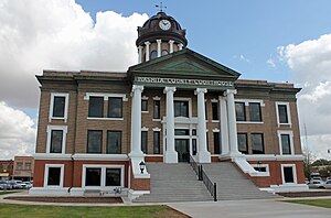
 Washita County Courthouse in 2015 | |
 Location within the U.S. state of Oklahoma | |
 Oklahoma's location within the U.S. | |
| Coordinates: 35°17′N 98°59′W / 35.29°N 98.99°W | |
| Country | |
| State | |
| Founded | 1891 |
| Named for | Washita River |
| Seat | New Cordell |
| Largest city | New Cordell |
| Area | |
| • Total | 1,009 sq mi (2,610 km2) |
| • Land | 1,003 sq mi (2,600 km2) |
| • Water | 5.6 sq mi (15 km2) 0.6% |
| Population (2020) | |
| • Total | 10,924 |
| • Density | 11/sq mi (4.2/km2) |
| Time zone | UTC−6 (Central) |
| • Summer (DST) | UTC−5 (CDT) |
| Congressional district | 3rd |
Washita County is a county in the U.S. state of Oklahoma. As of 2020, 10,924 people lived there.[1] Its county seat is New Cordell. It was formerly in Cloud Chief, Oklahoma.
- ↑ "QuickFacts: Washita County, Oklahoma". United States Census Bureau. Retrieved January 19, 2024.